Layered conservation efforts for flood resilience
Located near the Martin Covered Bridge and John Fowler Road, the site is visible from Route 2. The berm had been in place for many decades, built to limit flooding into the adjacent farm field.
The Winooski River continued to flood the field regularly, including during the historic floods of 2023 and 2024.
Some years before, we had prioritized the riverside area for conservation. In 2021, we partnered with the Vermont Department of Environmental Conservation to protect nearly 20 acres with a River Corridor Easement. That means the land along the river is permanently set aside so a band of forest can regrow over time, and the river has space to move.
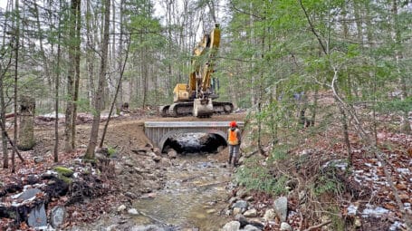
But the berm was still in place, and the area needed to be restored.
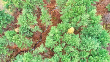
Photo: Floodwaters in 2024 covered the now-removed berm. Photo by Marie Maclay.